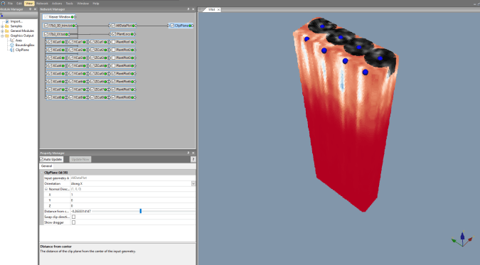
3D Modelling of GPR data, attempting to visualize Cassava roots in-situ. The black-and-white areas are the individual plants that we have separated from the larger data set to do plant-by-plant analysis.
Winter at the ISGS means field work slows down, and especially since the last week or two have been frigid! For now, we have several things we are working on that will take plenty of time in-office to complete. I have been working the past week or so on developing an automation code (Visual basic language) to turn XYZ data from Ground-Penetrating Radar into a 3-D model we can use to estimate volume and mass of cassava roots in-situ. We started this process last year, and you can find information on that process here. We have tweaked the methodology this year to make our analysis quantitative and to improve the data recovery.
Students are working on digitization of geophysical data as old as the 1930s. This is a time-consuming process, but will hopefully produce great, public-facing resources similar to ILWater.

You must be logged in to post a comment.