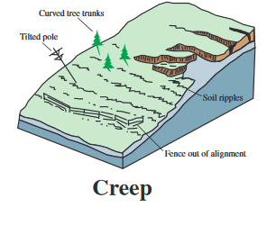
One of the areas of applied research we have been doing more of lately at the ISGS is delineation of landslides and creep failures. These occur on steep slopes where water works its way into the subsurface and reduces the friction that is holding the slope up.
We have been working on using seismic and electrical geophysical methods to image the failure surfaces in landslides, to help engineers better understand the scale and type of remediation to undertake.
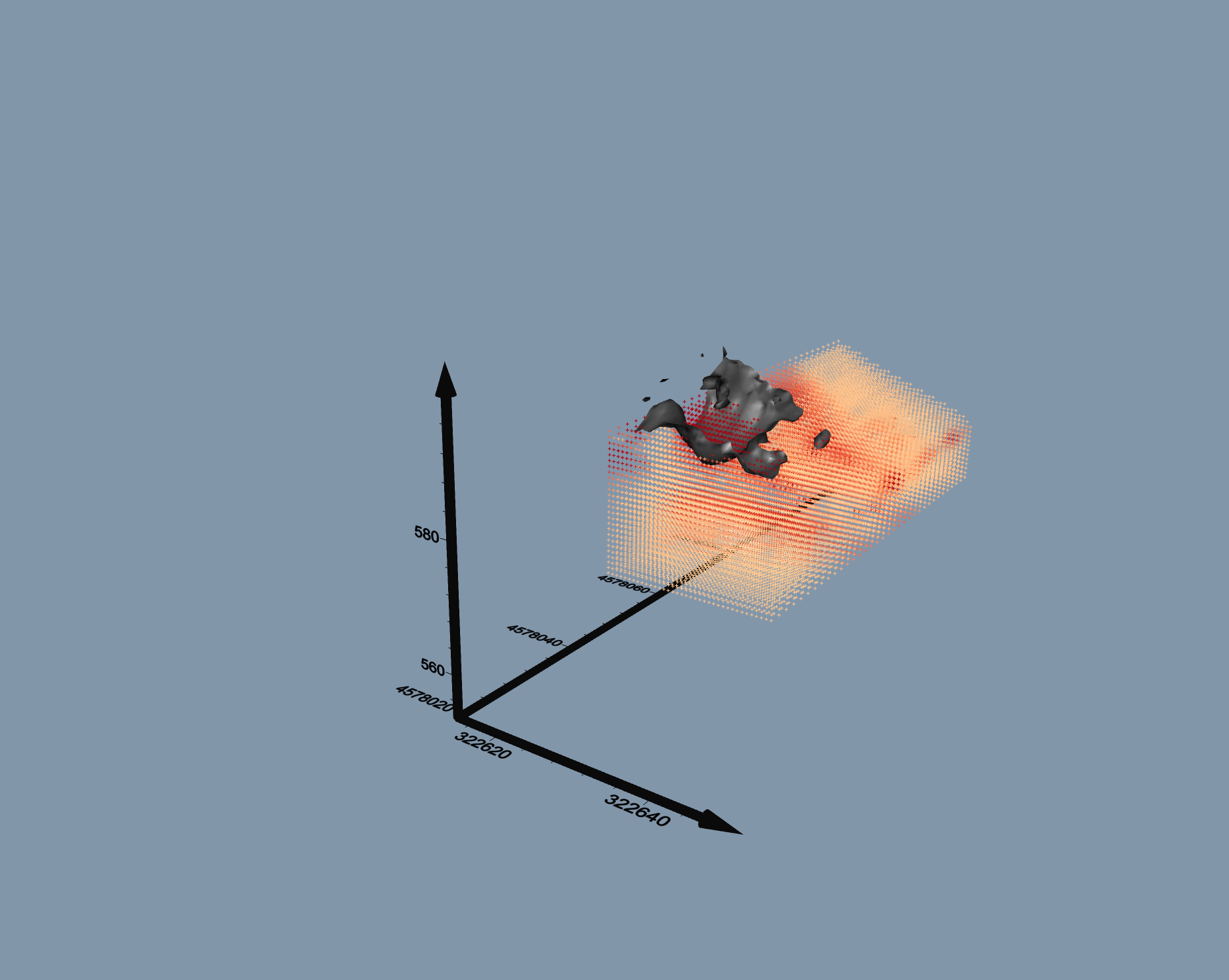
One recent example of the 3D modelling we have done with the data collected via electrical resistivity is shown below. The higher intensity red is higher conductivity, which at this site correlates to the failing material. The black is the approximate interface between the stable ground and the landslide material.


You must be logged in to post a comment.